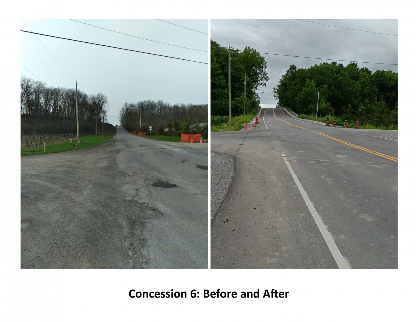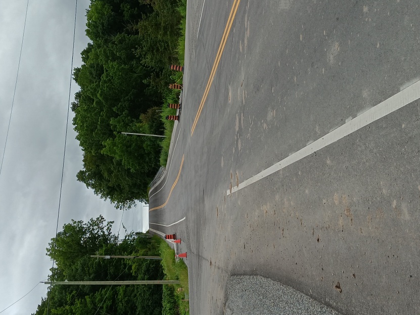
Concession 6


I was employed by the Town of Niagara-on-the-Lake in the Roads Department for over 25 years. One of my biggest regrets when I was working with the Town was not taking pictures. But then, road construction and changes are not very glamorous, and I am not a very good photographer. With recent changes made to Concession 6, I thought it would be interesting to look at the before and after pictures and share a bit of history about this road.
The roads in the early days of Niagara Township basically followed established Indigenous trails, for example along the lakeshore and the Niagara River, Queenston Road, and a trail along the Four Mile Creek. The Town lots granted to the early settlers were laid out in rectangular sections. Because of this, the numbered lines and concessions were made to follow the same square-ish pattern. The earlier road/trails did not follow a grid pattern, so the roads in the former Niagara Township seem confusing and haphazard. The lines run in roughly an east/ west direction, with the concessions running in a north/south direction. They are approximately 1/2 mile or 800 meters apart in each direction. All the concessions begin at East and West Line. Concession 6 has the distinction of being the longest, going all the way to the Niagara Falls border and connecting with Mewburn Road in Niagara Falls.
Concession 6 was gravel topped for most of its history. It was in the mid 1980's that drainage improvements were done, and a hard surface of tar and chip was added to the road surface. This was done in sections and not fully completed until the early 1990's. With these improvements came more traffic volumes. For locals this meant an alternative route to Niagara Falls; however, there was a problem. The spot where Con 6 crested over the escarpment was narrow, with trees and utility poles close to the road. It was nerve-racking hoping any oncoming traffic was not hogging the road. Also, just inside the Niagara Falls border was a railroad bridge. This bridge was a simple design, narrow and not built for heavy traffic. So, this route into Niagara Falls was not well used.
With an increase in tourism and development, this route to Niagara Falls was becoming more attractive. The bridge was eventually deemed unsafe and blocked to vehicular traffic. Discussions followed as to who was responsible for the bridge and who would pay for the reconstruction. This involved the rail authority, City of Niagara Falls, Niagara Region, and the Town of Niagara-on-the-Lake. Eventually the matter was settled, and a new modern bridge was built. This left the Town to make improvements to the road section going over the escarpment. The pictures show the before and after of this section. Concession 6 is becoming a favoured route to Niagara Falls and may rival Creek Road someday.
- Rick Meloen